
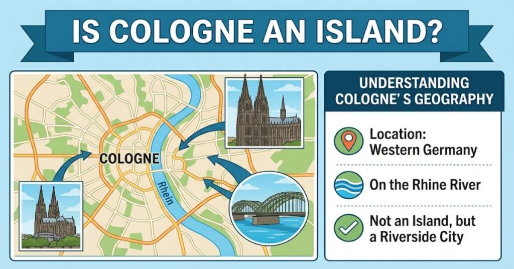
If you have searched “is cologne an island”, the straightforward answer is no. Cologne, known in German as Köln, is a major city in North Rhine-Westphalia, Germany, situated along the Rhine. The river runs through the city and separates areas on its western and eastern banks, but that does not make Cologne itself an island.
This distinction matters because a city surrounded by or divided by water can sometimes be mistaken for an island. Cologne’s relationship with the Rhine is particularly visible because several major bridges connect the two sides of the city. The official city administration identifies important Rhine crossings including the Mülheim Bridge, Deutz Bridge, Hohenzollern Bridge, Severins Bridge, South Bridge and Zoobrücke.
The simplest way to picture Cologne is therefore as a river city, not an island city. Its urban area extends across both sides of the Rhine, while roads, railways, pedestrians and cyclists use bridges to move between them.
That geography has influenced Cologne for centuries. The river has been a transport corridor, an economic asset and a defining feature of the cityscape.
Cologne’s Geography Explained
Cologne is commonly described through the terms left bank and right bank of the Rhine. In German urban planning and statistics, the distinction is also used officially. City statistics divide Cologne’s population into left-Rhine and right-Rhine areas. At the end of 2025, the city recorded 693,587 residents on the left bank and 406,489 on the right, giving a total population of 1,100,076.
| Geographic feature | What it means for Cologne |
| Rhine River | Runs through the city and separates its two urban sides |
| Left bank | Contains much of the historic central city |
| Right bank | Includes districts such as Deutz and Mülheim |
| Bridges | Provide road, rail, cycling and pedestrian connections |
| Island status | Cologne itself is not an island |
This distinction provides an important clue. If Cologne were an island, the entire city would occupy land enclosed by water. Instead, the Rhine passes through the urban area, with developed land extending on both sides.
Why Does Cologne Sometimes Seem Like an Island?
The confusion is understandable. Water strongly shapes the city’s visual identity.
The Rhine is prominent from many parts of Cologne, particularly around the historic centre and riverside districts. The famous Cologne Cathedral stands close to the river, while the Hohenzollern Bridge connects the central railway area with Deutz on the opposite bank.
The density of bridges adds to the impression that Cologne is defined by water. The city administration describes several Rhine bridges as important connections between the two sides. The Hohenzollern Bridge, for example, forms a major railway connection alongside Cologne Central Station.
The key geographical difference is therefore between a river crossing and an island boundary. A bridge over a river does not imply that the land around it is an island.
Rhine Geography vs Island Geography
| Feature | Cologne | Typical island city |
| Main water feature | Rhine River | Surrounding sea, lake or river |
| Land divided by water | Yes | Usually no internal division by a major river |
| Urban land on both sides | Yes | Depends on location |
| Bridges across central waterway | Numerous | Possible, but not defining by itself |
| Entire city surrounded by water | No | Yes |
The Rhine and Cologne’s Cultural Identity
Understanding Cologne’s geography requires more than looking at a map. The Rhine has helped shape the city’s cultural and economic identity.
Cologne developed as an important settlement along one of Europe’s major waterways. Its position encouraged connections between inland areas and wider European trade networks. In modern times, the river remains important for transport, infrastructure, recreation and tourism.
The city’s most recognisable landmark reinforces this connection. Cologne Cathedral, whose construction began in 1248 and was completed in 1880, has been a UNESCO World Heritage Site since 1996. UNESCO describes the cathedral as an exceptional Gothic monument with outstanding universal value.
The cathedral’s proximity to the Rhine also contributes to the distinctive visual relationship between historic architecture and the river. From across the water, the cathedral forms a dominant element of Cologne’s skyline.
This is one reason visitors may associate Cologne so strongly with its river. The relationship is geographical, architectural and cultural at the same time.
Does Cologne Have Islands?
The answer becomes more nuanced when discussing smaller pieces of land within the wider Rhine environment.
A river city can contain river islands, small natural features or engineered landforms without the entire city being an island. These should not be confused with the geographical status of Cologne itself.
This distinction is useful when reading maps or planning a visit. Seeing water around a particular district, harbour area or riverside feature does not mean that Cologne as a municipality is surrounded by water.
The city’s official statistics reinforce this interpretation by explicitly measuring its population according to left-bank and right-bank areas.
Three Useful Facts About Cologne’s River Geography
| Insight | Evidence or significance |
| Cologne has more than one urban side | Official statistics separately identify left-Rhine and right-Rhine populations |
| Bridges are strategically important | The city maintains multiple major Rhine crossings |
| Water influences heritage planning | UNESCO protection includes the cathedral and its surrounding visual context |
One less obvious point is that the Rhine is not merely scenic infrastructure. The location of major bridges affects daily mobility, railway connections and urban development. The city is currently planning and carrying out substantial work on several Rhine crossings, demonstrating how important these structures remain to Cologne’s functioning.
A second insight is that Cologne’s population is distributed unevenly between the two riverbanks. The 2025 figures show a substantially larger population on the left bank than the right.
A third is that the river creates planning constraints as well as opportunities. Construction projects involving the Rhine and other major waterways require regulatory approval, while infrastructure has to account for the physical environment surrounding the watercourse.
The Future of Cologne’s River Geography in 2027
By 2027, Cologne’s basic geography will remain unchanged: the Rhine will continue to divide the urban area into left-bank and right-bank districts.
What can change is how effectively the city connects those areas. Bridge maintenance and replacement projects are already part of Cologne’s long-term infrastructure planning. The city has identified major rehabilitation programmes for several bridges, with some work extending into the late 2020s and beyond.
For residents and visitors, this means the practical experience of crossing the Rhine may evolve even though the underlying geography does not.
The important point is that Cologne’s future is not about becoming an island or losing its river identity. It is about maintaining the infrastructure that allows a large city to function effectively on both sides of a major European waterway.
Key Takeaways
- Cologne is a German river city, not an island.
- The Rhine separates the city’s left and right banks.
- Official statistics use the Rhine as a meaningful geographical division.
- Major bridges connect Cologne’s two urban sides.
- The Rhine remains central to transport, heritage and city planning.
- Cologne Cathedral’s position near the river strengthens the city’s distinctive visual identity.
Conclusion
The answer to “is cologne an island” is clearly no. Cologne is a large German city built along both banks of the Rhine. Its geography can seem confusing because the river is highly visible and numerous bridges connect important districts across the water.
Rather than being surrounded by water, Cologne is shaped by a river running through its urban environment. That distinction explains why the city has left-bank and right-bank districts, an extensive bridge network and a strong cultural relationship with the Rhine.
The river is also part of Cologne’s historic identity. Its position has influenced transport, development and tourism, while landmarks such as Cologne Cathedral have become closely associated with the riverside cityscape. Current infrastructure projects show that managing connections across the Rhine remains an important part of Cologne’s future.
FAQ
Is Cologne an island?
No. Cologne is a city in western Germany located on both sides of the Rhine River. The river passes through the urban area rather than completely surrounding the city.
Is Cologne surrounded by water?
No. Cologne is not surrounded by water. The Rhine runs through the city, separating its left and right banks.
What river runs through Cologne?
The Rhine runs through Cologne. It is one of the most important geographical features of the city and has influenced its transport, history and urban development.
Does Cologne have two sides?
Yes. Cologne is commonly described as having left-bank and right-bank areas of the Rhine. Official city statistics use this distinction when reporting population figures.
Is Cologne Cathedral on an island?
No. Cologne Cathedral stands in the central urban area close to the Rhine, near Cologne Central Station. It is not located on an island.
Why does Cologne have so many bridges?
The Rhine divides the city’s urban area, so bridges are essential for connecting road, rail, pedestrian and cycling networks between both banks.
Methodology
This article was researched using official City of Cologne statistical and infrastructure information alongside UNESCO documentation on Cologne Cathedral. The analysis distinguishes between the geographical definition of a city and the presence of a major river running through it.
No firsthand field reporting, personal travel observations or independent infrastructure testing were conducted for this article. Population figures refer to the City’s published statistics, while heritage claims are based on UNESCO records. The geographical conclusion is straightforward, but individual riverside features should be assessed separately rather than treated as evidence that the entire city is an island.
This article was drafted with AI assistance and should be reviewed and verified by a human editor before publication.
References
Stadt Köln. (2026). Kölner Monatszahlen: Bevölkerungsentwicklung in Köln. Amt für Stadtentwicklung und Statistik.
Stadt Köln. (2026). Statistik Bevölkerung in Köln. Amt für Stadtentwicklung und Statistik.
Stadt Köln. (2026). Brücken. Stadtverwaltung Köln.
Stadt Köln. (2026). Zahlen und Statistik. Stadtverwaltung Köln.
UNESCO World Heritage Centre. (2026). Cologne Cathedral. UNESCO.